Geo Artificial Intelligence
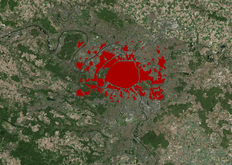
Artificial Intelligence (AI) also known as “machine intelligence” emphasizes the creation of intelligent machines and applications that work and react like humans using complex computer programming algorithms. AI entails speech recognition, learning, reasoning, perception problem solving etc. We employ Geospatial Artificial Intelligence (Geo-AI) which is a new form of machine learning (core part of AI) based on a geographic component i.e. in mapping, map intepretation urban traffic and BIG data analysis; and feature extration from satellite/drone images through Deep Learning (DL).
Geo Artificial Intelligence
We employ AI, ML and DL technology to address and solve spatial problems.
READ MORE..
Augmented & Virtual Reality
3D GIS modelling is fused with AR and VR transorm how we tell spatial stories!
READ MORE..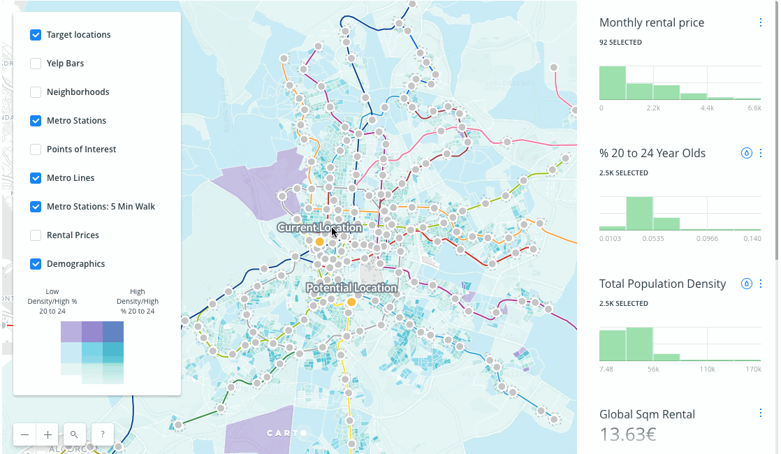
GIS Big Data Analytics
GIS BIG Data entails drone and satellite data, weather as well as traffic data.
READ MORE..At Orbital Africa, we employ robust AI technology tools to build 3D maps using high-quality geographic data to create 3D visualizations, run simulations, and develop dynamic location-based experiences and applications. Robust digital map-making power for developers to quickly create virtual worlds, smart buildings and much more. We build various web, mobile, VR, or AR applications using the WRLD 3D maps SDKs as well as map design tools.